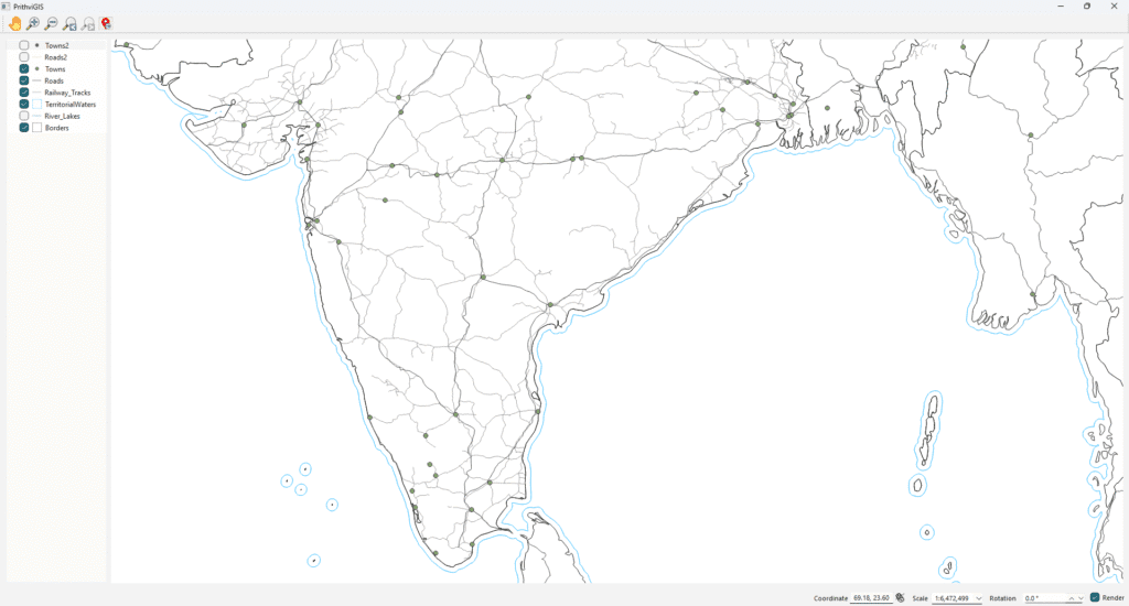
QGIS

How to Add a Raster Image in QGIS Using Qt, C++, and QGIS API

Introduction In Geographic Information Systems (GIS), raster data represents information in a grid-based structure such as satellite imagery, aerial photographs, digital elevation models (DEM), or scanned maps. Unlike vector data, which uses points, lines, and polygons, raster data provides continuous coverage across a geographic area. QGIS, one of the most powerful open-source GIS platforms, provides […]

How to Add a Raster Image in QGIS Using Qt, C++, and QGIS API Read More »

Custom GIS and Simulation Services - Manya Technologies

Real-Time Sensor Data Integration in QGIS with C++ & Qt for Defense and Enterprise Applications

Introduction In mission-critical operations — whether it’s border security, military mission planning, or enterprise asset tracking — decisions rely on live, accurate data. Static maps are no longer enough. Teams need real-time geospatial awareness, where sensor inputs update instantly on the map. At Manya Technologies, we integrate radar, drone telemetry, IoT sensors, and other live

Real-Time Sensor Data Integration in QGIS with C++ & Qt for Defense and Enterprise Applications Read More »

Custom GIS and Simulation Services - Manya Technologies

Offline ChatGPT-like Assistant for Enterprise, Defense, and Privacy-Conscious Users | Manya Technologies

In an era where artificial intelligence is becoming a core part of decision-making, communication, and research, there’s one major concern that keeps organizations — especially in defense, government, and enterprise sectors — from fully embracing it: data privacy. Most modern AI assistants like ChatGPT require internet connectivity and rely on cloud-based servers. This means every

Offline ChatGPT-like Assistant for Enterprise, Defense, and Privacy-Conscious Users | Manya Technologies Read More »

Shapefile Properties - Manya Technologies

Displaying Vector Layer Properties in a Qt, QGIS, C++ Application

When building GIS applications with QGIS C++ and Qt, giving users direct access to vector layer properties is a must. The QgsVectorLayerProperties dialog in QGIS provides a familiar and powerful interface for managing symbology, metadata, attribute tables, labeling, and much more. In this article, we’ll walk through how to open and manage the vector layer

Displaying Vector Layer Properties in a Qt, QGIS, C++ Application Read More »

Scroll to Top