Manya Technologies at Drone Expo 2026 – Visit Us at Stall F5
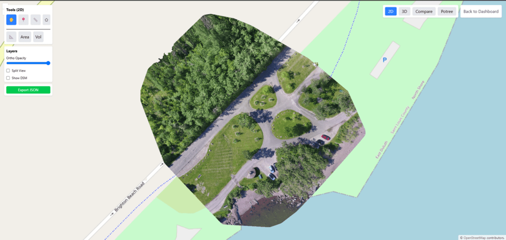
We are excited to announce that Manya Technologies will be participating in Drone Expo 2026, one of the leading events for drone and geospatial technology in India. 📍 Venue: Bangalore International Exhibition Centre📅 Dates: 17th & 18th March 2026📌 Stall: F5 Showcasing DroneMapX and More At this year’s expo, we will be presenting our flagship […]
Manya Technologies at Drone Expo 2026 – Visit Us at Stall F5 Read More »