Manya Technologies

display-moving-aircrafts-qt-arcgis-map-sdk-Manya Technologies

Display Moving Aircrafts in Qt using ArcGIS Maps SDK (Qt/C++)

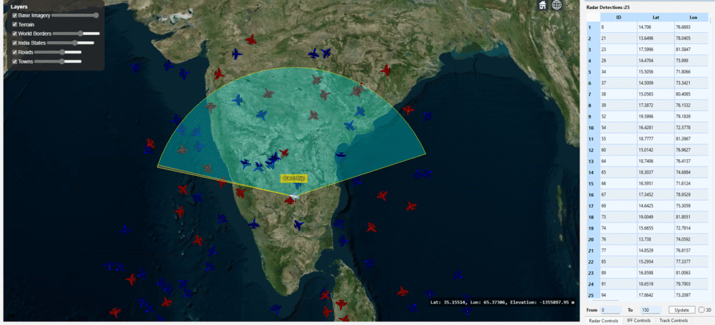
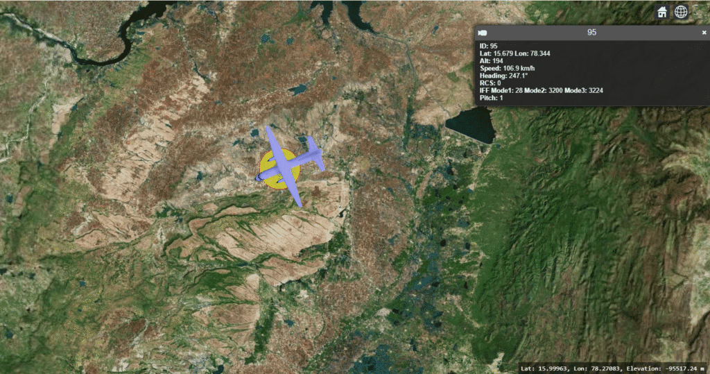
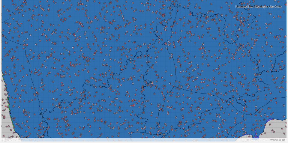
Introduction Displaying and tracking moving aircrafts on a live map is a key feature in applications like air traffic monitoring, radar simulation, and situational awareness systems. With the ArcGIS Maps SDK for Qt, developers can create high-performance map displays that render dynamic objects—like aircrafts—moving in real time.In this tutorial, we’ll show how to display multiple […]

Display Moving Aircrafts in Qt using ArcGIS Maps SDK (Qt/C++) Read More »

arcgis-map-sdk-Shapefile-Manya Technologies

Display Shapefiles Using ArcGIS Maps SDK for Qt (C++)

Introduction Shapefiles are one of the most common GIS data formats used for representing geographic features such as countries, roads, rivers, and cities. The ArcGIS Maps SDK for Qt provides a powerful and efficient way to display shapefiles directly in a Qt-based C++ desktop application, allowing you to build rich, interactive GIS tools. In this

Display Shapefiles Using ArcGIS Maps SDK for Qt (C++) Read More »

arcgis-map-sdk-Manya Technologies

Displaying a Basemap in a Qt C++ Application Using ArcGIS Map SDK

Geospatial applications have become critical in a wide variety of industries—from urban planning and logistics to defense and environmental monitoring. Visualizing geospatial data efficiently and interactively can be challenging, but modern mapping SDKs like the ArcGIS Map SDK for Qt provide powerful tools to make this easier. In this blog, we’ll explore how to display

Displaying a Basemap in a Qt C++ Application Using ArcGIS Map SDK Read More »

cesium3d-geojson-Manya technologies

How to Add Shapefiles (as GeoJSON) in CesiumJS and Control Their Visibility & Opacity

Introduction CesiumJS is a powerful open-source 3D globe and map engine that allows developers to visualize geospatial data in real-time. However, since Cesium doesn’t directly support shapefiles (.shp), we typically convert them to the more web-friendly GeoJSON format. In this tutorial, we’ll see how to: This is particularly useful when building GIS visualization tools, map

How to Add Shapefiles (as GeoJSON) in CesiumJS and Control Their Visibility & Opacity Read More »

STK DME track detection - Manya Technologies

Detecting Tracks Using STK DME Component

Introduction In modern defense and aerospace systems, radar-based track detection plays a critical role in situational awareness and threat assessment. Using Analytical Graphics Inc. (AGI) STK DME components, developers can simulate realistic radar sensors, model target motion, and compute detections based on signal-to-noise ratio (SNR), field of view (FOV), and radar cross-section (RCS). This post

Detecting Tracks Using STK DME Component Read More »

target-details-Manya technologies

How to Display Track Details on Click in CesiumJS

Introduction In real-time 3D visualization systems such as air traffic, maritime tracking, or defense simulations, it’s essential to view detailed information about each moving target.CesiumJS, a powerful open-source 3D globe engine, makes this possible through its viewer.selectedEntityChanged event — allowing you to show track details when a user clicks on an entity. In this post,

How to Display Track Details on Click in CesiumJS Read More »

PrithviGIS

PrithviGIS: India’s Indigenous GIS Solution Empowering Local Development

India is increasingly emphasizing indigenous technology development, encouraging homegrown solutions across sectors. In the geospatial domain, PrithviGIS, developed by Manya Technologies, stands out as a fully indigenous GIS application built on the robust QGIS platform. PrithviGIS offers a wide range of features tailored to India’s local needs, including real-time radar track display, 3D visualization, vector

PrithviGIS: India’s Indigenous GIS Solution Empowering Local Development Read More »

stk-aircraft-simulation-manya-technologies

Creating and Animating Aircraft in STK Engine with Python

Systems Tool Kit (STK) is widely used for modeling, simulating, and visualizing aerospace and defense scenarios. With STK Engine, you can embed STK’s 2D/3D visualization inside your own applications and fully control it programmatically. In this blog, we’ll see how to: Prerequisites Python Code Below is a simplified example. It creates 5 aircraft with random

Creating and Animating Aircraft in STK Engine with Python Read More »

Raster display using cesium - Manya Technologies

How to Display a Raster Image at a Specific Location in CesiumJS

Introduction CesiumJS is a powerful open-source library for creating 3D geospatial applications on the web. While it is widely used for visualizing vector data, 3D tiles, and terrain, raster imagery also plays a crucial role in many applications. Raster images such as satellite snapshots, scanned maps, or custom overlays can provide valuable context to your

How to Display a Raster Image at a Specific Location in CesiumJS Read More »

Scroll to Top