What Is a Point Cloud in Drone Mapping? A Complete Guide
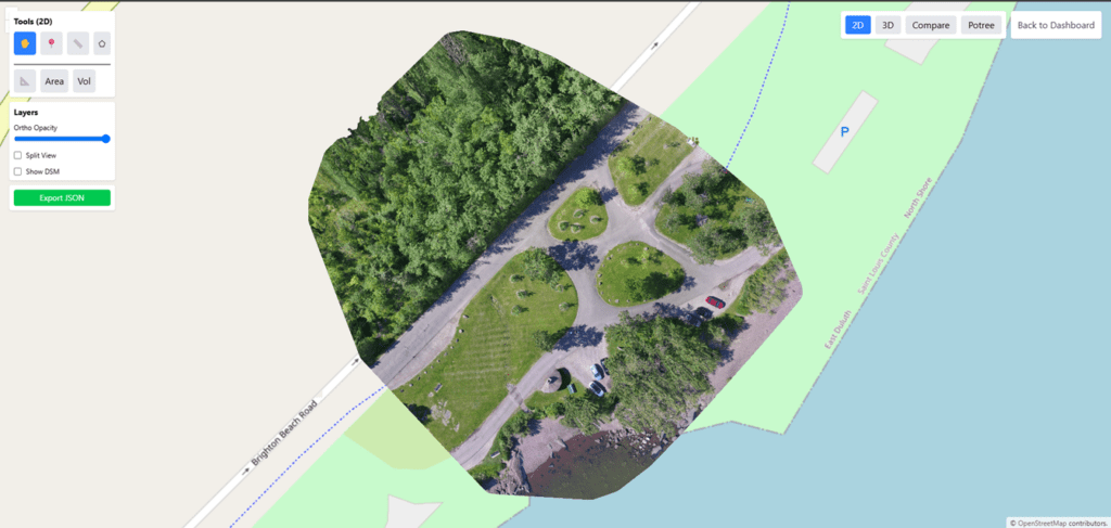
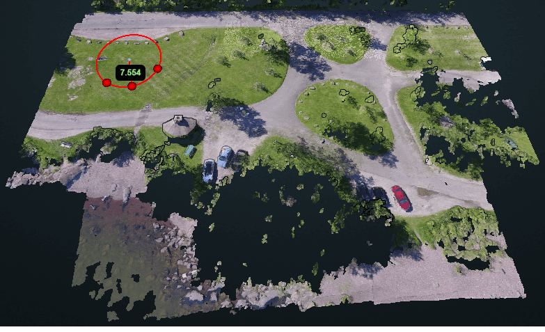
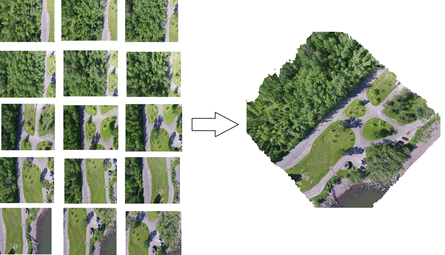
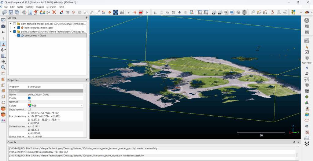
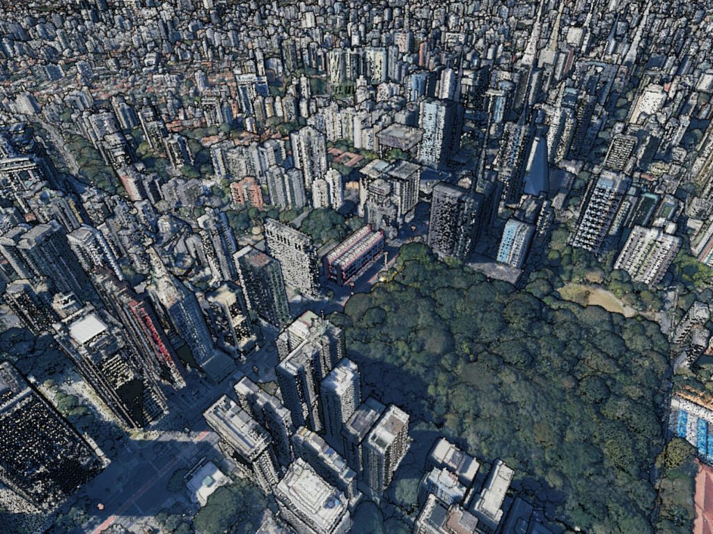
Introduction Drone mapping has transformed how we capture, analyze, and visualize the real world. At the heart of this transformation lies point cloud data—a highly detailed 3D representation of terrain, structures, and objects captured from the air.In this blog, we’ll explain what a point cloud is in drone mapping, how it is generated, its key […]
What Is a Point Cloud in Drone Mapping? A Complete Guide Read More »