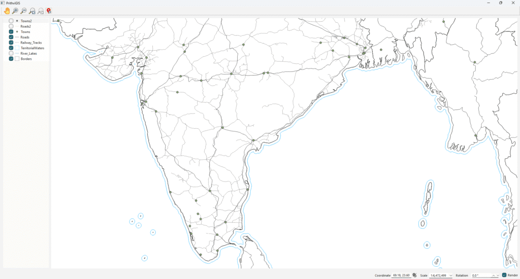
Building a Basic Vector Map Display in QGIS with Zoom, Pan, and Rotation Controls
When developing custom GIS applications, a common requirement is to display vector maps with basic navigation options like zooming in/out, panning, navigating back/forward, and even rotating the map. Using the QGIS API with Qt, we can achieve this in just a few steps. In this post, we’ll walk through a simplified example application that loads […]
Building a Basic Vector Map Display in QGIS with Zoom, Pan, and Rotation Controls Read More »