Drone Mapping

Orthomosaic Display - Manya Technologies

How to Display Orthomosaic Images Generated by OpenDroneMap Using OpenLayers

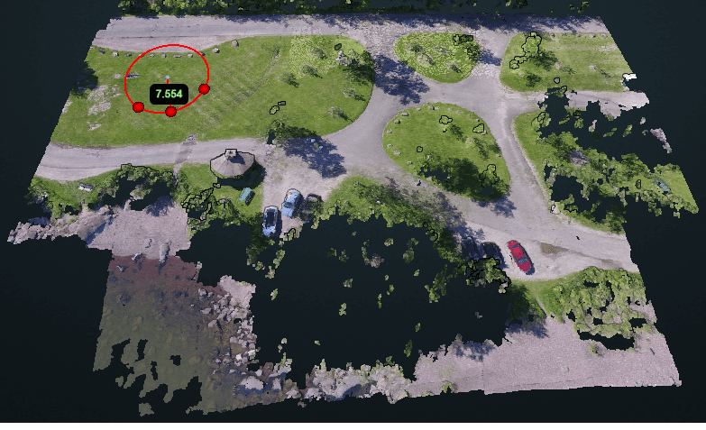
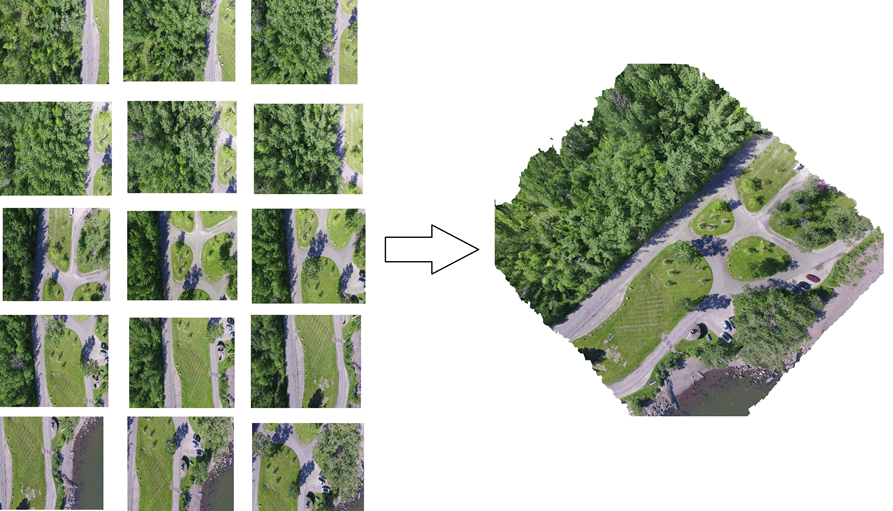
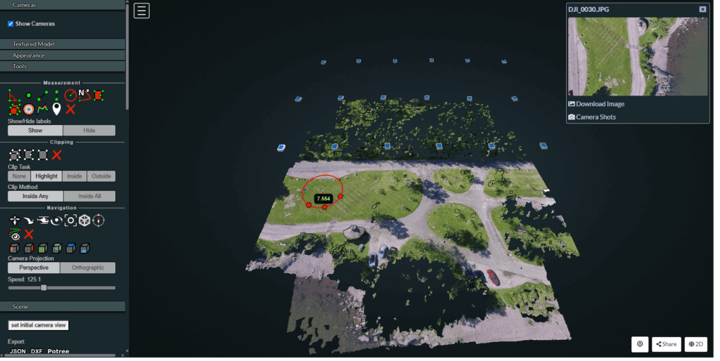
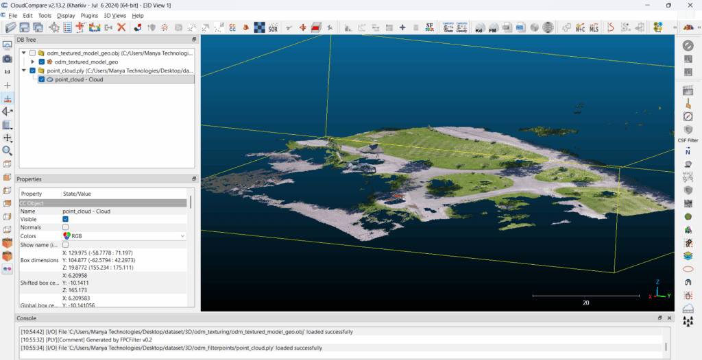
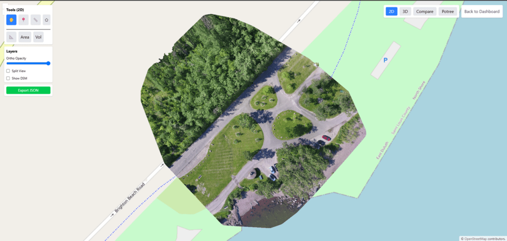
Introduction Drone mapping has become essential across industries—agriculture, construction, mining, urban planning, utilities, and environmental monitoring. With tools like OpenDroneMap (ODM), it is now possible to process raw drone images into highly accurate geospatial outputs such as orthomosaics, DSM, point clouds, and 3D models. Once an orthomosaic is generated, the next step is to display […]

How to Display Orthomosaic Images Generated by OpenDroneMap Using OpenLayers Read More »

Open Drone Map (ODM) - Manya Technologies

OpenDroneMap (ODM): The Complete Guide for Beginners — Family, Usage, Customization

Drone mapping has become essential across industries—agriculture, mining, construction, power utilities, disaster management, smart cities, and more. If you want to build high-quality 2D/3D maps from drone images without depending on expensive proprietary tools, OpenDroneMap (ODM) is one of the best open-source solutions available today. In this article, we’ll explore: What Is OpenDroneMap? OpenDroneMap (ODM)

OpenDroneMap (ODM): The Complete Guide for Beginners — Family, Usage, Customization Read More »

drone mapping-DSM-DTM-DEM-Manya Technologies.png

DSM vs DTM vs DEM: Differences Explained with Examples

Understanding the difference between DSM (Digital Surface Model), DTM (Digital Terrain Model), and DEM (Digital Elevation Model) is essential for anyone working in drone mapping, surveying, GIS, construction monitoring, or environmental modelling. Although these terms sound similar, each represents a different type of elevation data and serves a specific purpose. In this guide, we break

DSM vs DTM vs DEM: Differences Explained with Examples Read More »

Drones Mapping - Manya Technologies

What Is Drone Mapping? A Beginner’s Guide for Businesses

Drone mapping has become one of the most powerful tools for modern businesses. From construction and farming to mining and urban planning, drones now deliver accurate maps, measurements, and insights in a fraction of the time compared to traditional surveying. If you’re new to this technology, here’s a simple guide to understand what drone mapping

What Is Drone Mapping? A Beginner’s Guide for Businesses Read More »

Orthomosaics Generation - Manya Technologies

How Orthomosaics Are Generated: Step-by-Step Guide

Orthomosaics are one of the most valuable outputs in drone mapping, providing highly accurate, distortion-free aerial images used in surveying, agriculture, construction, disaster assessment, mining, and more. But how exactly are orthomosaics created? In this post, we break down the step-by-step process—from flying the drone to generating a map-ready orthomosaic. 1. Flight Planning The process

How Orthomosaics Are Generated: Step-by-Step Guide Read More »

drone mapping-Manya Technologies

Why Building Your Own Custom Drone Mapping Software Can Be More Cost-Efficient Than Using DroneDeploy or Pix4D

Drone mapping has become essential across industries—from agriculture and mining to construction, utilities, and defense. Most companies start with commercial SaaS platforms like DroneDeploy or Pix4D, which offer powerful features but also come with recurring subscription costs, usage limitations, and restricted customization. As organizations grow, these limitations often become expensive bottlenecks. This is where building

Why Building Your Own Custom Drone Mapping Software Can Be More Cost-Efficient Than Using DroneDeploy or Pix4D Read More »

Point Cloud Visualization-Manya Technologies

Point Cloud Visualization: What It Is, Why It Matters, and How to View It Using Potree, CloudCompare & More

Point clouds have become a core data format in today’s geospatial, surveying, mapping, and 3D reconstruction workflows. Whether the data comes from drones, LiDAR sensors, photogrammetry, or laser scanners, point cloud visualization is essential for inspection, analysis, measurements, and 3D understanding. In this article, we break down what point clouds are, why visualization matters, and

Point Cloud Visualization: What It Is, Why It Matters, and How to View It Using Potree, CloudCompare & More Read More »

Using ONNX TensorRT for Faster Inspection AI Models - Manya Technologies

Using ONNX/TensorRT for Faster Inspection AI Models (Cracks, Corrosion, Oil Spills)

Introduction Industries such as construction, oil & gas, maritime, aerospace, and infrastructure maintenance increasingly rely on AI-based inspection. However, traditional deep-learning models can be slow when deployed on edge devices like drones, embedded systems, or industrial PCs. As datasets grow and inspection demands increase, the need for faster inference becomes critical. This is where ONNX

Using ONNX/TensorRT for Faster Inspection AI Models (Cracks, Corrosion, Oil Spills) Read More »

drone mapping-Manya Technologies

Drone Mapping: Revolutionizing the Way We See the World

In today’s digital era, drone mapping has transformed how we capture, visualize, and analyze our surroundings. By combining drones with advanced mapping and visualization technologies, organizations can generate high-resolution maps, 3D models, and spatial datasets faster and more affordably than ever before. What is Drone Mapping? Drone mapping is the process of using unmanned aerial

Drone Mapping: Revolutionizing the Way We See the World Read More »

Scroll to Top