December 2025

Orthomosaic - QGIS - Manya Technologies

How to Use QGIS for Drone Mapping Display and Analysis

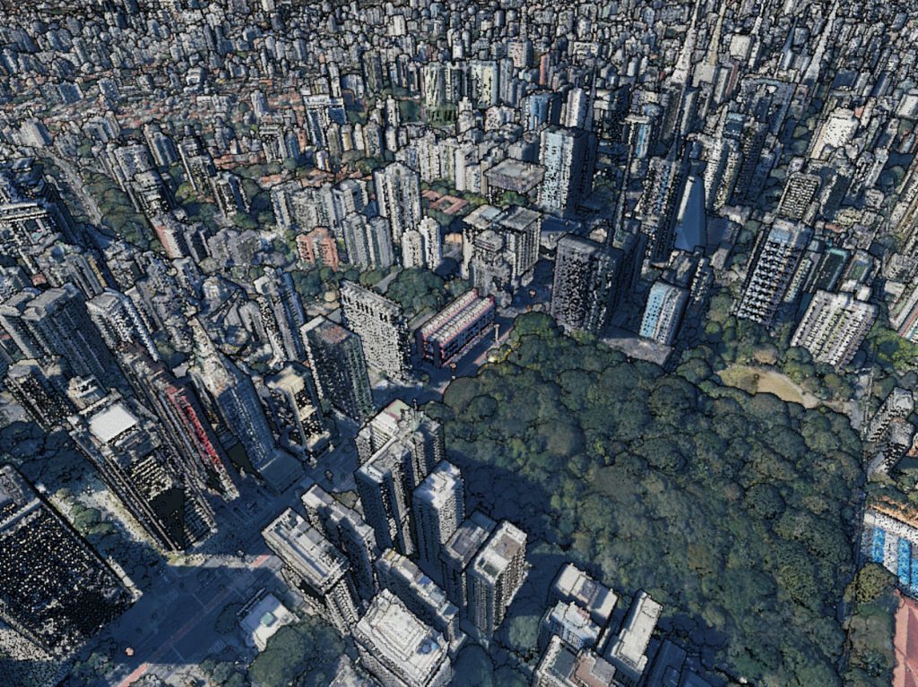
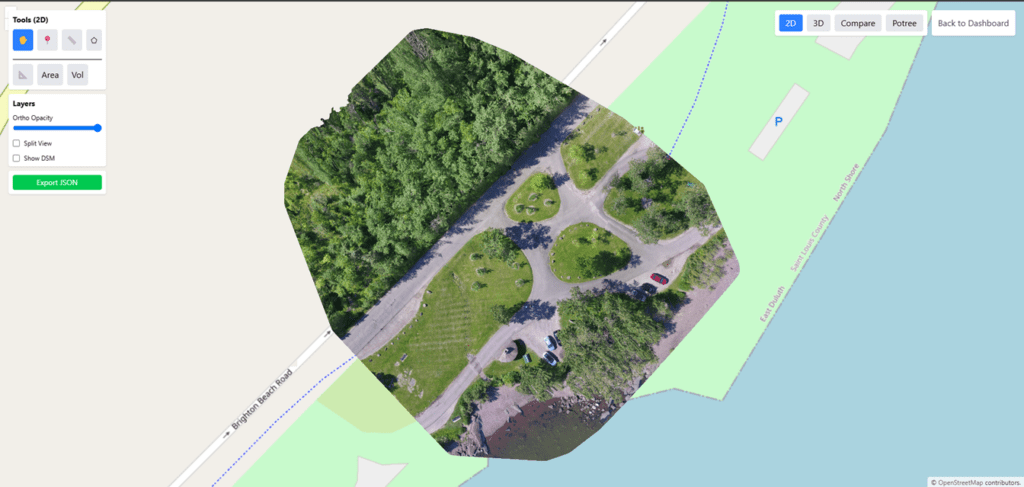
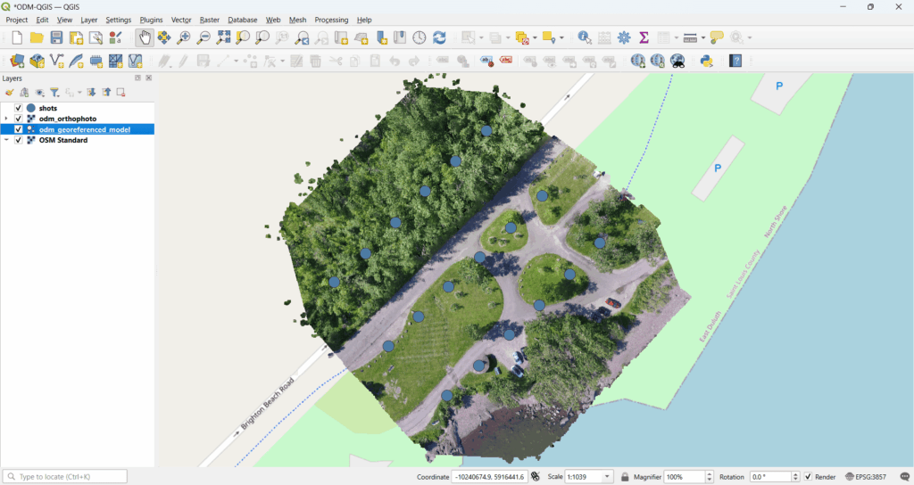
Drone mapping has become a core technology across surveying, infrastructure, agriculture, mining, smart cities, and defense applications. While photogrammetry software like Pix4D or OpenDroneMap is used to generate orthophotos and point clouds, QGIS plays a crucial role in visualization, analysis, and delivery of drone mapping outputs. In this blog, we explain how QGIS is used […]

How to Use QGIS for Drone Mapping Display and Analysis Read More »

QGIS Temporal Controller - Manya technologies

QGIS Temporal Playback: Visualizing Time-Based Geospatial Data Effectively

Introduction Modern GIS applications are no longer limited to static maps. Many real-world problems involve change over time—moving vehicles, evolving land use, weather patterns, sensor feeds, flight paths, or historical data analysis.This is where QGIS Temporal Playback becomes a powerful feature. QGIS provides a built-in Temporal Controller that allows users to visualize, animate, and analyze

QGIS Temporal Playback: Visualizing Time-Based Geospatial Data Effectively Read More »

QGIS Commercial Support Listing - Manya Technologies

Custom GIS Application Development Using QGIS in India

Introduction Geographic Information Systems (GIS) are no longer limited to static maps or desktop analysis tools. In India, GIS has become a critical technology backbone for sectors such as defense, smart cities, infrastructure, utilities, transportation, drones, logistics, and disaster management. While off-the-shelf GIS software works for generic needs, many organizations quickly hit limitations when workflows

Custom GIS Application Development Using QGIS in India Read More »

Data Distribution Service (DDS) - Manya Technologies

What is DDS (Data Distribution Service)? Components, Use Cases, and Implementation with Fast DDS

Introduction Modern real-time systems—such as radar displays, defense command systems, UAV control, GIS-based tracking platforms, and industrial automation—require extremely fast, reliable, and scalable data exchange. Traditional client-server or REST-based communication models often fail to meet strict latency and reliability requirements. This is where DDS (Data Distribution Service) comes in. DDS is a high-performance, data-centric publish–subscribe

What is DDS (Data Distribution Service)? Components, Use Cases, and Implementation with Fast DDS Read More »

Drone Mapping - QGIS - Manya Technologies

Can QGIS Be Used in Drone Mapping for Specific Areas?

Introduction Drone mapping has become an essential tool across industries such as construction, agriculture, mining, urban planning, and defense. While many people associate drone mapping with expensive cloud platforms, open-source GIS tools like QGIS play a critical role, especially when working on specific project areas rather than large global datasets. A common question we hear

Can QGIS Be Used in Drone Mapping for Specific Areas? Read More »

Wireframe - Manya Technologies

What Is a Wireframe? A Beginner-Friendly Guide for Drone Mapping Software UI/UX

When building any digital product—especially something complex like a web-based drone mapping software—the first and most important step is creating a wireframe. Wireframes act as the backbone of your product’s user interface, helping you structure your ideas clearly before a single line of code is written. In this article, we’ll explain what wireframes are, why

What Is a Wireframe? A Beginner-Friendly Guide for Drone Mapping Software UI/UX Read More »

Ground Control Points - Manya Technologies

What Is a Ground Point (GCP) in Drone Mapping? Why It Matters for Accurate Results

Drone mapping has transformed how we create maps, 3D models, and measurements of the real world. However, the accuracy of drone-generated maps does not depend only on good cameras and flight plans—it critically depends on Ground Control Points (GCPs). In this blog, we’ll explain: What Is a Ground Point (GCP)? A Ground Control Point (GCP)

What Is a Ground Point (GCP) in Drone Mapping? Why It Matters for Accurate Results Read More »

Point Cloud - Manya Technologies

What Is a Point Cloud in Drone Mapping? A Complete Guide

Introduction Drone mapping has transformed how we capture, analyze, and visualize the real world. At the heart of this transformation lies point cloud data—a highly detailed 3D representation of terrain, structures, and objects captured from the air.In this blog, we’ll explain what a point cloud is in drone mapping, how it is generated, its key

What Is a Point Cloud in Drone Mapping? A Complete Guide Read More »

Point Cloud Display - Manya Technologies

How to Display Point Clouds Using Potree (Beginner-Friendly Guide)

Introduction Point clouds are becoming a core part of modern drone mapping workflows—especially when working with LiDAR data or photogrammetry outputs. But visualizing these massive 3D datasets on the web can be challenging. This is where Potree, an open-source point cloud renderer, becomes an incredibly powerful tool. In this post, you’ll learn what point clouds

How to Display Point Clouds Using Potree (Beginner-Friendly Guide) Read More »

Orthomosaic Display - Manya Technologies

How to Display Orthomosaic Images Generated by OpenDroneMap Using OpenLayers

Introduction Drone mapping has become essential across industries—agriculture, construction, mining, urban planning, utilities, and environmental monitoring. With tools like OpenDroneMap (ODM), it is now possible to process raw drone images into highly accurate geospatial outputs such as orthomosaics, DSM, point clouds, and 3D models. Once an orthomosaic is generated, the next step is to display

How to Display Orthomosaic Images Generated by OpenDroneMap Using OpenLayers Read More »

Scroll to Top