webodm

Open Drone Map (ODM) - Manya Technologies

OpenDroneMap (ODM): The Complete Guide for Beginners — Family, Usage, Customization

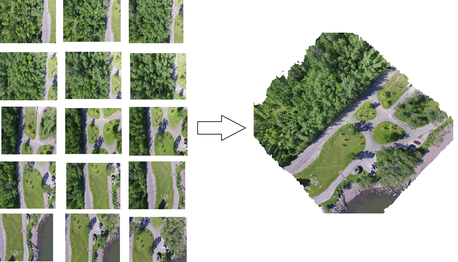
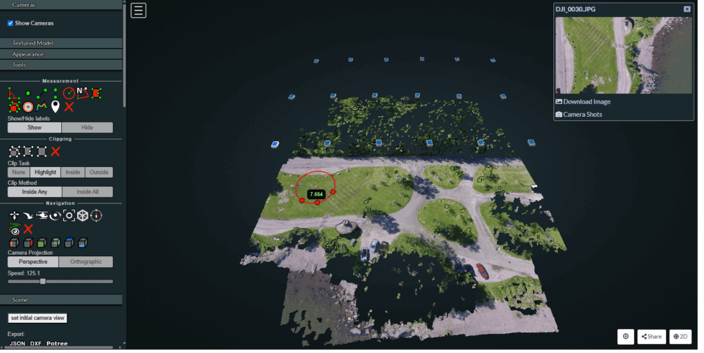
Drone mapping has become essential across industries—agriculture, mining, construction, power utilities, disaster management, smart cities, and more. If you want to build high-quality 2D/3D maps from drone images without depending on expensive proprietary tools, OpenDroneMap (ODM) is one of the best open-source solutions available today. In this article, we’ll explore: What Is OpenDroneMap? OpenDroneMap (ODM) […]

OpenDroneMap (ODM): The Complete Guide for Beginners — Family, Usage, Customization Read More »

Orthomosaics Generation - Manya Technologies

How Orthomosaics Are Generated: Step-by-Step Guide

Orthomosaics are one of the most valuable outputs in drone mapping, providing highly accurate, distortion-free aerial images used in surveying, agriculture, construction, disaster assessment, mining, and more. But how exactly are orthomosaics created? In this post, we break down the step-by-step process—from flying the drone to generating a map-ready orthomosaic. 1. Flight Planning The process

How Orthomosaics Are Generated: Step-by-Step Guide Read More »

drone mapping-Manya Technologies

Why Building Your Own Custom Drone Mapping Software Can Be More Cost-Efficient Than Using DroneDeploy or Pix4D

Drone mapping has become essential across industries—from agriculture and mining to construction, utilities, and defense. Most companies start with commercial SaaS platforms like DroneDeploy or Pix4D, which offer powerful features but also come with recurring subscription costs, usage limitations, and restricted customization. As organizations grow, these limitations often become expensive bottlenecks. This is where building

Why Building Your Own Custom Drone Mapping Software Can Be More Cost-Efficient Than Using DroneDeploy or Pix4D Read More »

Scroll to Top