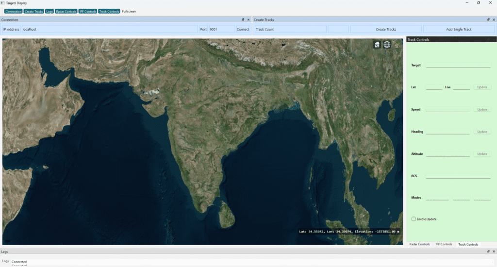
Real-Time 2D Track Display Using Qt GraphicsScene
Introduction Qt’s Graphics View Framework (QGraphicsView, QGraphicsScene, QGraphicsItem) is widely used for building real-time 2D visualization systems such as radar displays, tactical maps, UAV monitoring dashboards, and simulation tools. In this article, we walk through how a radar-like 2D track display is implemented using Qt GraphicsScene, including: Only key code fragments are shown to explain […]
Real-Time 2D Track Display Using Qt GraphicsScene Read More »