Introduction
Drone mapping has transformed how we capture, analyze, and visualize the real world. At the heart of this transformation lies point cloud data—a highly detailed 3D representation of terrain, structures, and objects captured from the air.
In this blog, we’ll explain what a point cloud is in drone mapping, how it is generated, its key applications, how to create and visualize point clouds, and how Manya Technologies delivers custom, cost-effective drone mapping solutions tailored to your needs.
What Is a Point Cloud in Drone Mapping?
A point cloud is a collection of millions (or even billions) of 3D points, where each point has X, Y, and Z coordinates representing its position in space.
In drone mapping, these points are generated from overlapping aerial images or LiDAR scans captured by drones.
Each point may also contain additional attributes such as:
- Color (RGB values)
- Intensity
- Classification (ground, building, vegetation, etc.)
Together, these points form an accurate 3D digital replica of the real world.
How Is a Point Cloud Generated in Drone Mapping?
Point clouds are typically created using photogrammetry or LiDAR.
1. Data Capture Using Drones
A drone flies over a predefined area and captures high-resolution images with sufficient front and side overlap (usually 70–80%). GPS and IMU data help georeference the images.
2. Image Processing & Photogrammetry
Specialized software analyzes overlapping images to identify common features and calculates their 3D positions using Structure from Motion (SfM) algorithms.
3. Dense Point Cloud Creation
The software generates a dense collection of 3D points representing the terrain and objects in the scene.
4. Georeferencing & Refinement
Ground Control Points (GCPs) may be used to improve accuracy. Noise filtering and classification are applied to produce a clean, usable dataset.
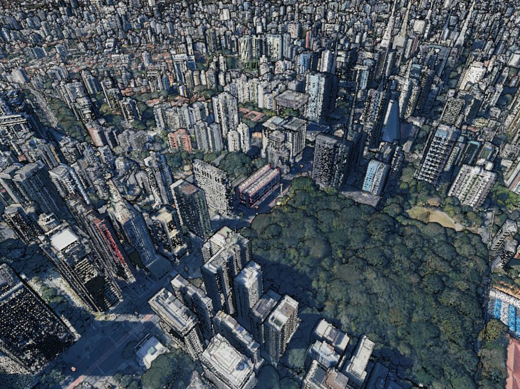
Common Uses of Point Clouds in Drone Mapping
Point clouds are widely used across industries due to their precision and flexibility.
Key Use Cases
- Topographic surveys
- Construction progress monitoring
- Volume calculations (cut & fill, stockpiles)
- Urban planning and smart cities
- Infrastructure inspection (roads, bridges, towers)
- Mining and quarry analysis
- Disaster management and flood modeling
- Forestry and vegetation analysis
Because point clouds retain raw spatial accuracy, they act as the foundation for generating DSM, DTM, DEM, orthomosaics, and 3D models.
How to Create a Point Cloud from Drone Images
You can generate a point cloud using open-source or commercial software.
Typical Workflow
- Capture drone images with sufficient overlap
- Import images into processing software
- Run feature matching and alignment
- Generate a dense point cloud
- Export in standard formats like LAS, LAZ, PLY, or XYZ
Popular Tools
- OpenDroneMap (ODM)
- Dronedeploy
- Pix4D
- Agisoft Metashape
- RealityCapture
Open-source tools like OpenDroneMap are ideal for organizations looking for customization, offline processing, and cost efficiency.
How to Display and Visualize Point Cloud Data
Once generated, point clouds can be visualized using web or desktop solutions.
Web-Based Visualization
- Potree for large-scale point cloud rendering
- WebGL-based viewers for browser access
- Integration with maps like OpenStreetMap or Cesium
Desktop Visualization
- CloudCompare
- QGIS with point cloud support
- Custom desktop viewers for secure/offline environments
Visualization allows users to:
- Measure distances, areas, and volumes
- Classify and filter data
- Analyze elevation and terrain features
Custom Drone Mapping & Point Cloud Solutions by Manya Technologies
At Manya Technologies, we specialize in building custom drone mapping software and point cloud solutions tailored to your operational needs.
What We Offer
- Custom point cloud processing pipelines
- Web-based and offline desktop point cloud viewers
- Potree and Cesium-based visualization
- OpenDroneMap customization
- Secure on-premise deployments
- Scalable solutions for enterprise and government use
- Integration with GIS, databases, and existing systems
Why Choose Us?
- Cost-effective alternatives to expensive cloud platforms
- Full control over your data
- Offline and air-gapped support
- Custom workflows instead of one-size-fits-all tools
Whether you need a complete WebODM-like platform, a desktop drone mapping system, or custom analytics on point cloud data, we can build it for you.
Conclusion
Point clouds are the backbone of modern drone mapping, enabling accurate 3D analysis of the real world. From image capture to visualization, understanding the point cloud workflow empowers organizations to extract real value from drone data.
If you’re looking for a custom, scalable, and cost-effective drone mapping solution, Manya Technologies is ready to help.
Contact Us
📩 Get in touch with Manya Technologies to discuss your drone mapping or point cloud requirements.
🌐 Visit: https://manyatechnologies.com
💼 Custom GIS, drone mapping, and visualization solutions built for your needs.