PrithviGIS Features
Core features
Explore the powerful geospatial capabilities that make PrithviGIS a robust and reliable GIS platform for real-time operations, mapping, and analysis.
Vector & Raster Layer Support

- Support for multiple vector formats: Shapefiles, GeoJSON, PostGIS, etc.
- Raster formats: GeoTIFF, JPEG2000, DEMs, satellite imagery
- Multi-layer map support with full control over visibility and grouping
- Layer customization like color, fill type, line type, line color, point color, font, etc.
- 100+ vector layer support
- Layer ordering control
- Add/remove layer
- Move to top, move to bottom, zoom to layer options
- Copy/rename vector layers
- Scale based visibility
- Attribute table display
- Label display
Basic Map Tools

- Zoom, pan, fit to layer
- Zoom back, forward
- Viewport display
- Map rotate
- Jump to location
- Bookmarks
- Identify features
- Real-time mouse coordinates (Lat/Lon, UTM, etc.)
- Map scale bar
- Time display
- Scale display
- North arrow display
- Grid overlay
Symbology & Styling

- Per-layer symbol styling (color, opacity, line width, pattern)
- Rule-based and categorized styling (e.g., by type, status, speed)
- Transparency control
- Various symbol size
- Pattern display
- Simple, pattern, gradient, raster image based symbology
- Fill color, style selection
- Stroke color, style selection
- Easy one-time setup — persists with PostgreSQL-linked layers
- Single label, rule based label
- Symbol transparency control
- Label offset
Measurement & Annotation


- Distance measurement
- Area measurement
- Bearing measurement
- Angle measurement
- Multiple range display rings
- Multiple angular display lines
- 3D vertical measurements
- Drawing tools: circle, polyline, polygon, text
- Annotation symbology, color, etc.
- Undo/redo support for all annotation actions
- Save annotations as shapefiles or project overlays
3D Map Display


- Integrated with CesiumJS 3D map view
- Real-time elevation-aware rendering
- Real-time track and annotation display in 3D
- Home button
- Layer selection
- Track detailed info display
- Mouse pointer location and elevation display
- Search location
- Time based mission replay
Time-Based Data Control


- Timeline-based display using QGIS Temporal Controller
- Play/pause controls for visualizing historical movement
- Slider option
- Filter by time ranges or feature states
- Step count setting
- Loop mode display
- Multiple layer playback
- Time period selection
- Export animation as images
PostgreSQL/PostGIS Integration

- Automatic map updates when geometry/data changes in DB
- Automatic track update when data changes
- One-time setup: no code required for live updates
- Works seamlessly with PostGIS layers
- Attribute table display
- Edit geometry and attributes directly on map
- Changes saved back to PostGIS instantly
- Per second refresh
- All the mission data points, areas, lines, shapefiles, tracks can be managed in Postgres and displayed in PrithviGIS seamlessly
Raster Utilities

- Image Mosaic Creation – Combine multiple raster tiles into a seamless view
- Radiometric Adjustments – Modify histogram stretch, brightness, and contrast
- Spatial Tools – Resampling, alignment, reprojection
- Spectral Tools – Band math, pan sharpening, band combinations
- Georeferencing – Align non-geo images using ground control points
- Brightness & Contrast Control
- Transparency Slider per layer
- Blending Modes for raster overlays (e.g., multiply, lighten, etc.)
- RGB Band Assignment for satellite images
Real-Time Target Display


- Display 10,000+ Tracks Smoothly
- Optimized rendering of airborne, naval, and ground tracks in real-time
- Low-latency performance even with large datasets
- Various types of tracks and symbologies
- Lots of customization
- Real-time input via database, TCP/UDP, WebSocket
- Tracks update automatically as data changes in the backend (Optional)
Track Layer Controls
- Separate map layers for:
- ✈️ Airborne tracks
- 🚢 Naval tracks
- 🚚 Ground units
- Each layer has its own symbology, visibility toggles, and legends
Auto-Refresh
- PrithviGIS is tightly coupled with PostgreSQL/PostGIS
- No polling or manual refresh: map updates instantly on table changes
- Geometry updates reflect immediately with corresponding symbology
Input via Protocols
- Supports real-time input from:
- 🗃️ PostgreSQL/PostGIS
- 📡 TCP/UDP
- 🔌 WebSocket
- Easily integrate with simulators, sensors, or live feeds
Built on QGIS & Cesium Power


All Tools Backed by QGIS API & Cesium
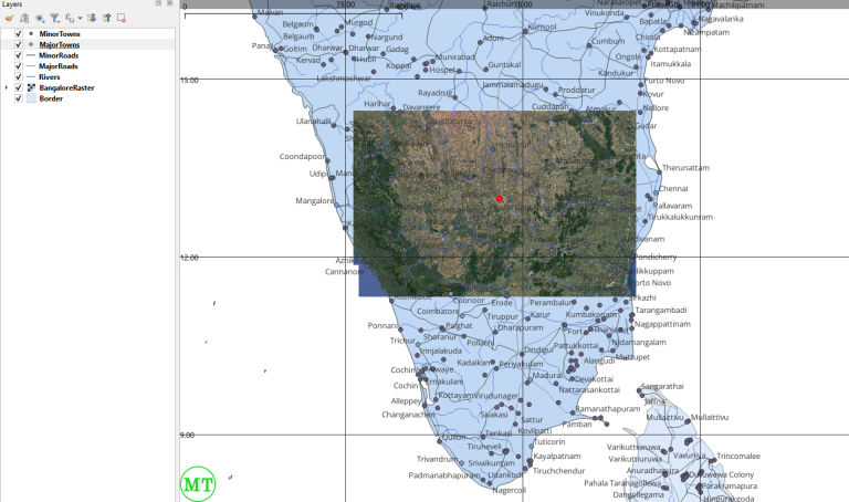
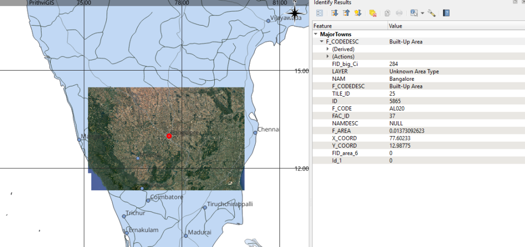
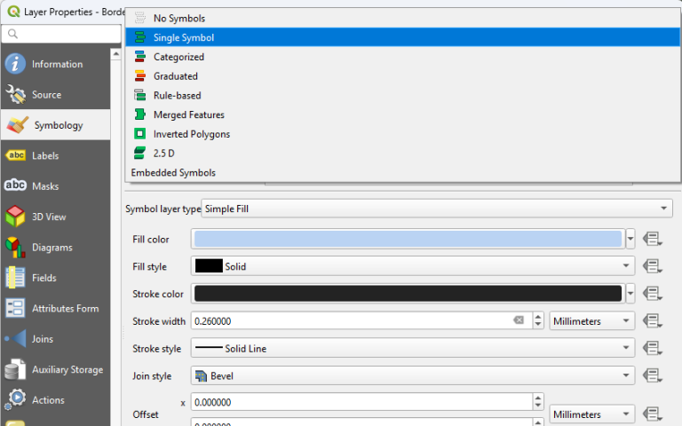
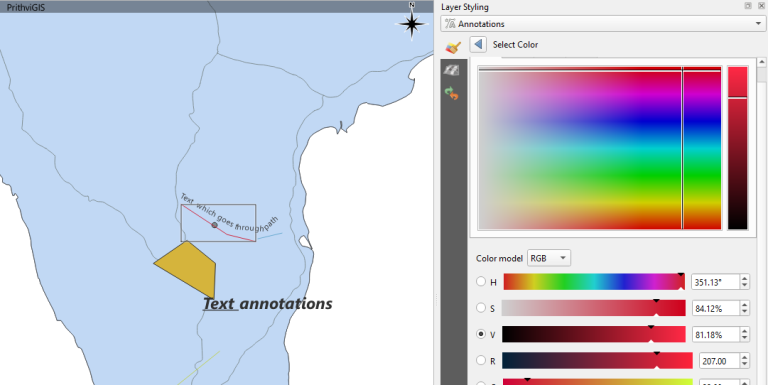
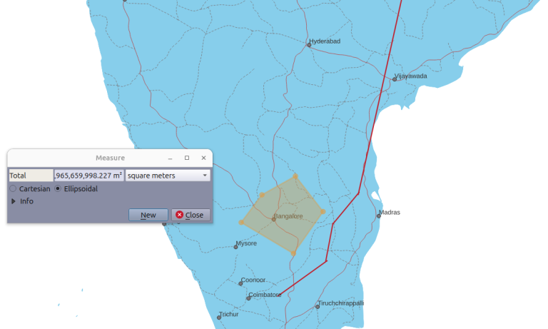
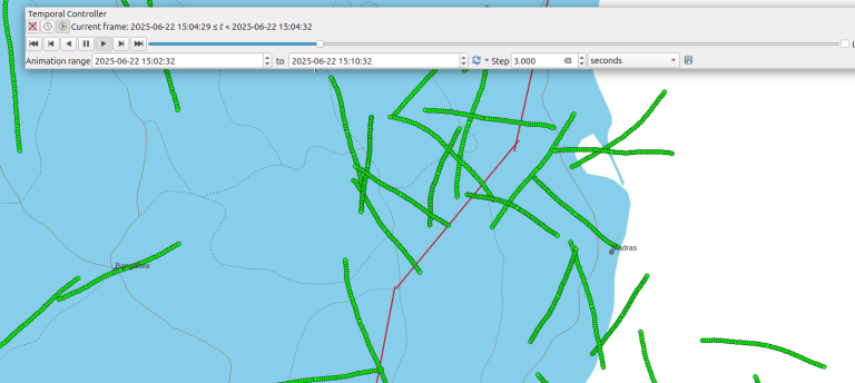
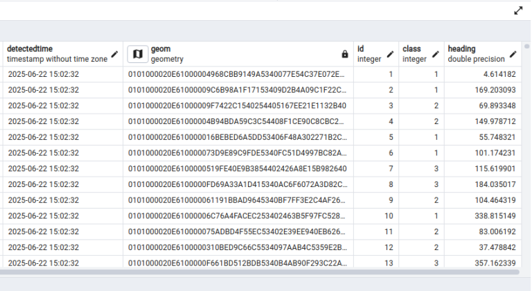
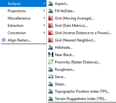
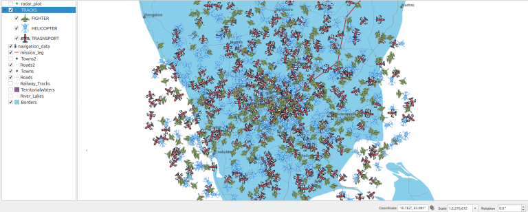
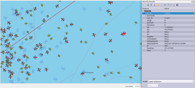
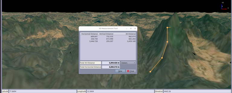
PrithviGIS inherits the depth and stability of the QGIS & Cesium ecosystem, with full access to core GIS functions, rendering engine, and plugins — tightly integrated in a simplified interface.
Would you like to start a custom GIS project with us?
Get in Touch for a Custom GIS Solution