India is increasingly emphasizing indigenous technology development, encouraging homegrown solutions across sectors. In the geospatial domain, PrithviGIS, developed by Manya Technologies, stands out as a fully indigenous GIS application built on the robust QGIS platform.
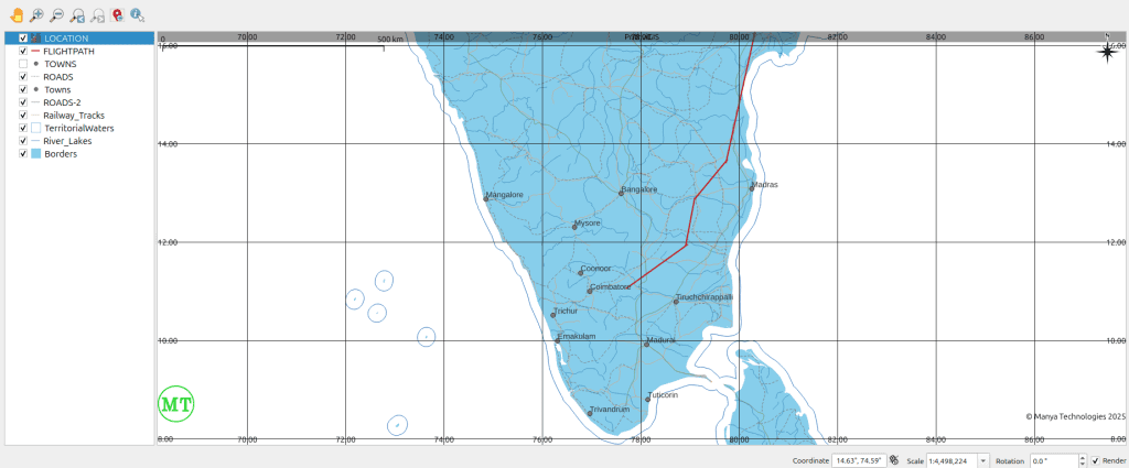
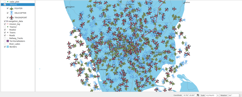
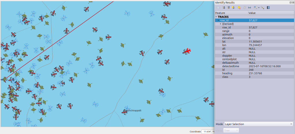
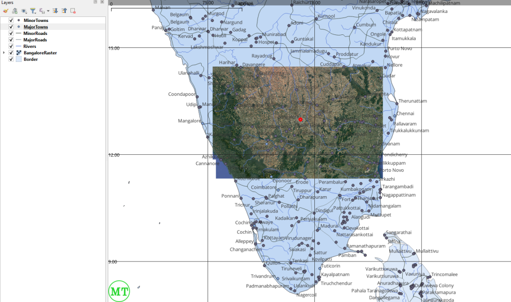
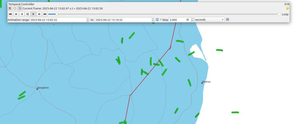
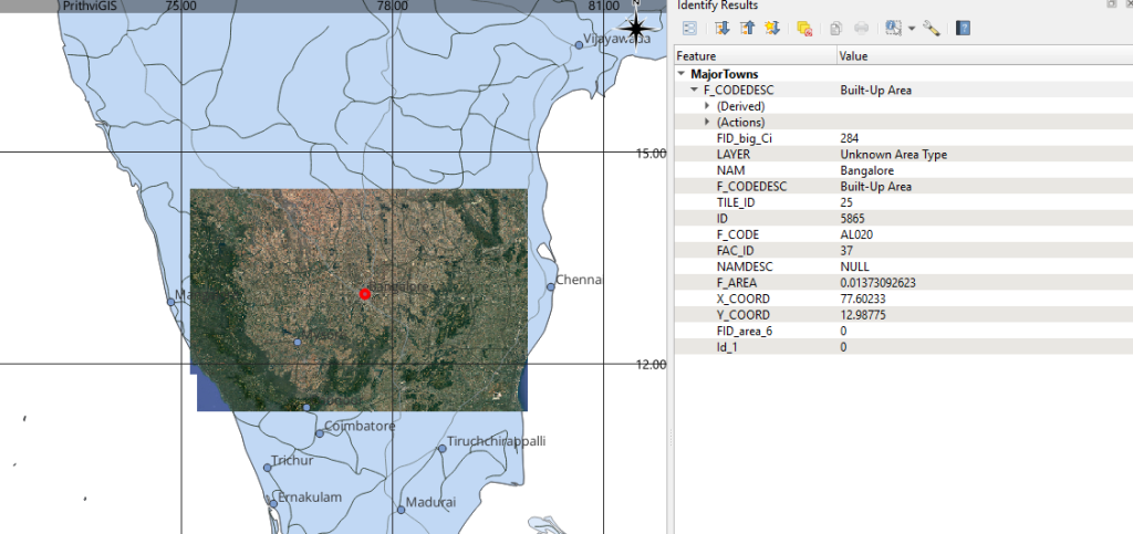
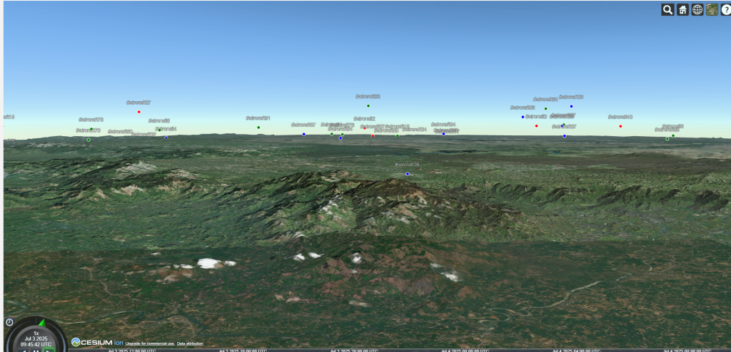
PrithviGIS offers a wide range of features tailored to India’s local needs, including real-time radar track display, 3D visualization, vector and raster mapping, temporal playback, and PostgreSQL/PostGIS integration for live data handling. This makes it ideal for government agencies, defense applications, research institutions, and enterprises requiring precise geospatial intelligence.
By leveraging open-source QGIS technology and enhancing it with custom modules, PrithviGIS ensures that India has a locally developed, secure, and adaptable GIS solution. This aligns perfectly with the national vision to reduce dependency on foreign software and promote homegrown technological capabilities.
For organizations looking for a reliable, indigenous GIS platform, PrithviGIS provides robust mapping tools, simulation capabilities, and advanced geospatial analytics, all designed and maintained within India.
With India pushing for more indigenous GIS projects, solutions like PrithviGIS are not just software—they represent a strategic move towards self-reliance in geospatial technology.
Key Benefits of PrithviGIS:
- Fully indigenous GIS application developed in India
- Real-time radar and sensor track visualization
- 2D and 3D mapping with advanced symbology
- Temporal playback and historical data analysis
- Seamless PostgreSQL/PostGIS integration for live updates
- Customizable for defense, government, and enterprise projects
Screenshots:

Conclusion:
PrithviGIS showcases the potential of indigenous GIS development in India, combining local expertise, advanced QGIS capabilities, and real-time geospatial solutions. As India encourages homegrown technology, adopting PrithviGIS ensures organizations are part of the self-reliant and innovative geospatial ecosystem.
Know more about PrithviGIS – Indigenous GIS in India Here.