Understanding the difference between DSM (Digital Surface Model), DTM (Digital Terrain Model), and DEM (Digital Elevation Model) is essential for anyone working in drone mapping, surveying, GIS, construction monitoring, or environmental modelling. Although these terms sound similar, each represents a different type of elevation data and serves a specific purpose.
In this guide, we break them down clearly with simple definitions, examples, and use-case comparisons.
What Is a Digital Elevation Model (DEM)?
A Digital Elevation Model (DEM) is a broad term that refers to any digital representation of the Earth’s elevation surface. It includes both bare-earth models and models with objects.
Think of “DEM” as the parent category.
Both DSM and DTM are types of DEM.
Where DEM is used
- Flood modelling
- Terrain analysis
- Contour generation
- Landform visualization
What Is a Digital Surface Model (DSM)?
A Digital Surface Model (DSM) captures the elevation of natural and man-made objects on the Earth’s surface.
It includes everything the drone or sensor sees from above.
DSM includes:
- Buildings
- Trees
- Vehicles
- Power lines
- Vegetation canopy
Simple example
If you fly a drone over a city, the DSM height at a location will be the top of the building, not the ground under it.
When DSM is useful
- Urban planning
- Telecom tower line-of-sight analysis
- Solar potential analysis (rooftop shading)
- 3D visualization
- Vegetation height estimation
What Is a Digital Terrain Model (DTM)?
A Digital Terrain Model (DTM) represents the bare-earth terrain, with all surface objects removed.
It shows the true ground elevation.
Processing software removes:
- Buildings
- Trees
- Shrubs
- Cars and machinery
Simple example
In the same city drone flight, the DTM height at that location will be the actual ground level, ignoring the building.
When DTM is useful
- Road and railway design
- Cut and fill calculations
- Hydrological modelling (water flow)
- Slope and contour analysis
- Environmental monitoring
DSM vs DTM vs DEM: Key Differences
| Model | Shows | Includes Objects? | Typical Use Cases |
|---|---|---|---|
| DEM | General term for elevation models | May or may not | Any elevation-based study |
| DSM | Surface with buildings, trees, vegetation | Yes | Solar modelling, telecom, city planning |
| DTM | Ground terrain only | No | Road design, hydrology, cut–fill, engineering |
How Are They Created?
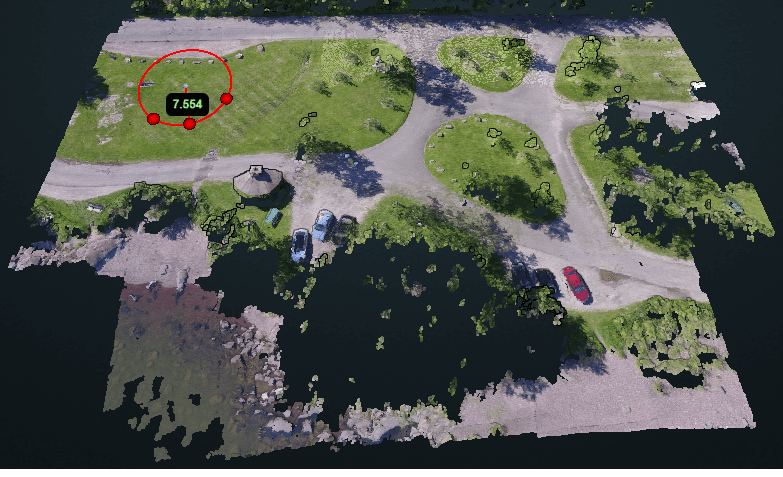
Drone Photogrammetry
- Drone images
- Ground control points (optional)
- Processing in:
- OpenDroneMap (ODM)
- WebODM
- Agisoft Metashape
- Pix4D
- RealityCapture
LiDAR
- Faster ground penetration
- More accurate DTMs in heavily vegetated areas
- Common in forestry and flood modelling
Real-World Examples
1. Construction Site Monitoring
- DSM → Shows top of stockpiles, machinery, and structures
- DTM → Used for accurate cut and fill calculations
- DEM → Base reference model
2. Solar Panel Feasibility Study
- DSM is essential because buildings and trees affect shading.
- DTM alone would not show rooftop shapes or obstructions.
3. Flood Risk Mapping
- DTM is used so the model can simulate water flow on actual ground.
- DSM would incorrectly block water using buildings/trees.
Which One Should You Use?
| Your Requirement | Best Model |
|---|---|
| Terrain analysis | DTM |
| Urban modelling, 3D views | DSM |
| Hydrology, flood modelling | DTM |
| Shadow analysis, telecom planning | DSM |
| General elevation mapping | DEM |
Final Thoughts
Knowing whether to use a DSM, DTM, or DEM is crucial for accurate terrain modelling, engineering design, and drone mapping workflows. A DSM helps you understand the visible surface, while a DTM reveals the true ground — and DEM acts as the umbrella term for all elevation data.
With modern drone photogrammetry and LiDAR tools, generating high-quality DSMs and DTMs is easier and more accessible than ever.
If your organization needs a custom drone mapping platform tailored to your exact workflow—faster, more secure, and far more cost-efficient than DroneDeploy or Pix4D—our team at Manya Technologies can help. We build end-to-end solutions including photogrammetry processing, 3D visualization, point-cloud handling, annotations, measurements, integrations, and AI-based analytics. Contact us today to discuss your requirements and get a fully customized, scalable, and budget-friendly drone mapping system for your business.