DroneMapX – A Smarter, Flexible Alternative to DroneDeploy & Pix4D
DroneMapX is an enterprise-grade drone mapping platform in active development, built for organizations that need offline processing, industry-specific workflows, AI features, and complete control over their data—without expensive licensing.
Popular drone mapping platforms such as DroneDeploy and Pix4D have accelerated adoption across industries. However, many enterprises encounter critical limitations when scaling these tools for real-world operations:
Mandatory cloud-only processing with limited offline capability
High and recurring subscription costs that scale poorly
Restricted customization for specialized workflows
One-size-fits-all pipelines across diverse industries
Data security, privacy, and sovereignty concerns
Additional licensing costs for advanced and AI-driven features
DroneMapX is being built to directly address these challenges, delivering enterprise-grade control, flexibility, and long-term cost efficiency.
DroneMapX vs DroneDeploy & Pix4D
🔍 Key Differentiators
Feature
DroneMapX
DroneDeploy
Pix4D
Offline Processing
✅ Yes
❌ No
⚠ Limited
Cloud Deployment
✅ Yes
✅ Yes
✅ Yes
Industry-Specific Plans
✅ Yes
❌ No
❌ No
AI-Based Features
✅ Built-in
⚠ Limited
⚠ Limited
Customization
✅ High
❌ Low
❌ Low
Pricing
✅ 50% cheaper
❌ High
❌ High
Flexible Payment
✅ Yes
❌ No
❌ No
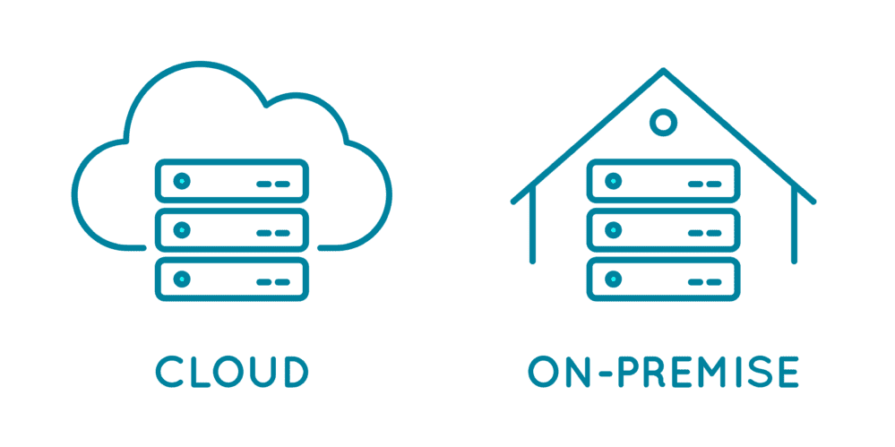
Built for Offline + Cloud
For your needs
Unlike many tools that force cloud usage, DroneMapX supports both:
Offline processing for defense, mining, and secure environments
Cloud-based workflows for scalability and collaboration
Hybrid deployment based on customer needs
Your data stays under your control.
Industry-Specific Plans (Segment-Based)
DroneMapX is not a one-size-fits-all product. We are building dedicated modules and plans for:
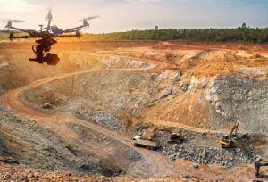
⛏ Mining
Stockpile volume calculation
Terrain change detection
Safety & compliance reporting
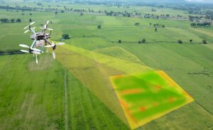
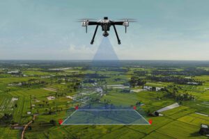
🌾 Agriculture
NDVI & crop health analysis
Irrigation monitoring
Yield estimation
🏗 Construction
Progress tracking
Cut/fill analysis
Design vs actual comparison
🛡 Defense & Government
Secure offline mapping
Terrain intelligence
Mission planning support
AI-Powered Features
DroneMapX integrates AI and automation to reduce manual effort and speed up insights
Automatic feature extraction
Change detection over time
Smart segmentation of terrain & assets
AI-assisted analytics dashboards
These features are being designed with real operational workflows, not generic demos.
Pricing That Makes Sense
We believe drone mapping software should be accessible and scalable.
💡 Our Pricing Philosophy
Minimum 50% cheaper than the cheapest mainstream tool
Segment-based pricing (pay only for what you need)
DroneMapX is being built with a strong focus on usability, flexibility, and enterprise readiness:
Clean, modern, and intuitive user interface
Dashboard-driven workflows for faster decision-making
Custom-built tools based on specific customer requirements
Scalable architecture designed for cloud and offline deployments
We build DroneMapX around real operational needs, not fixed templates or generic workflows.
Solving Problems Other Tools Don’t
DroneMapX directly addresses common complaints users have with existing platforms:
Offline dependency and forced cloud usage
High and inflexible licensing costs
Poor customization options
Limited enterprise and GIS integration
Generic, one-size-fits-all workflows
Our approach is simple: build with users, not just for users.
Free Online Demo & Early Access
DroneMapX is currently in active development.
Free online demo with real-world workflows
Requirement-based customization for your domain
Early-access advantages and feature prioritization
Direct interaction with the development team
Contact Manya Technologies today and be part of shaping DroneMapX to match your operational needs.
Build Your Drone Mapping Platform the Right Way
DroneMapX is not just another drone mapping tool—it’s a flexible, affordable, enterprise-ready platform designed to solve real-world challenges faced by users of DroneDeploy, Pix4D, and similar solutions.