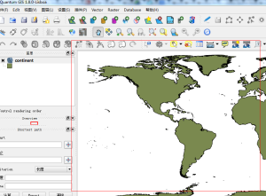
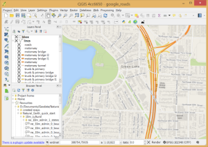
Geographic Information Systems (GIS) have become indispensable tools for managing and analyzing spatial data across various industries. Whether you’re working on environmental monitoring, urban planning, or resource management, having a robust GIS solution can make a significant difference. In this blog, we’ll explore how combining QGIS with Qt can enhance your GIS projects and offer a powerful, customized solution for your spatial data needs.
Why Choose QGIS and Qt?

QGIS (Quantum GIS) is an open-source GIS platform known for its versatility and ease of use. It supports a wide range of formats and provides a rich set of tools for spatial analysis, data visualization, and map creation. Qt, on the other hand, is a popular C++ framework used for developing cross-platform applications with a graphical user interface (GUI). By integrating QGIS with Qt, you can create tailored applications that offer a seamless user experience and extended functionality.
Benefits of Combining QGIS and Qt
- Customizable Interfaces: Qt’s powerful GUI capabilities allow you to design custom interfaces for your QGIS-based applications. Whether you need a specialized control panel, interactive maps, or user-friendly data input forms, Qt can help you build a tailored solution that meets your specific needs.
- Enhanced User Experience: Qt’s widgets and layout management features enable you to create intuitive and responsive interfaces. By integrating these with QGIS’s mapping and analysis tools, you can enhance the usability of your GIS application, making complex spatial data more accessible and manageable.
- Cross-Platform Compatibility: Both QGIS and Qt support multiple operating systems, including Windows, Linux, and macOS. This ensures that your GIS application can run smoothly across different platforms, making it easier to deploy and maintain.
- Extensibility and Integration: Qt provides extensive support for plugins and extensions, which can be used to add new features or integrate with other systems. This flexibility allows you to build on top of QGIS’s core functionalities and tailor your application to specific requirements.
Developing a GIS Solution with QGIS and Qt

Here’s a high-level overview of how you can leverage QGIS and Qt to develop a GIS solution:
1. Setting Up Your Development Environment
Start by setting up your development environment. Install QGIS and Qt on your system, and make sure you have the necessary tools and libraries for integrating them. Qt Creator is an excellent IDE for Qt development, and you can use it alongside QGIS’s Python API (PyQGIS) for scripting and customization.
2. Designing the Interface
Use Qt Designer to create the GUI for your application. Design the layout, add widgets such as buttons, maps, and forms, and set up the interactions. Qt’s signal and slot mechanism allows you to connect user actions with application logic seamlessly.
3. Integrating QGIS with Qt
Integrate QGIS into your Qt application by using the QGIS API. This involves setting up the QGIS environment within your Qt application and configuring it to load and display maps, layers, and other spatial data. You can leverage PyQGIS for scripting and automating tasks, such as data loading, spatial analysis, and map rendering.
4. Implementing Functionality
Implement the core functionalities of your GIS application. This may include loading different types of spatial data, performing spatial queries, generating maps, and creating custom analysis tools. Use Qt’s features to enhance user interactions, such as providing real-time feedback, interactive controls, and visualizations.
5. Testing and Deployment
Test your application thoroughly to ensure it works as expected across different platforms and scenarios. Address any bugs or issues, and optimize performance where needed. Once testing is complete, prepare your application for deployment and distribute it to your users.
Conclusion

Combining QGIS with Qt offers a powerful toolkit for developing customized GIS solutions. By leveraging QGIS’s spatial data capabilities and Qt’s GUI design features, you can create applications that are both functional and user-friendly. Whether you’re building a specialized tool for internal use or a commercial GIS product, this combination provides the flexibility and power needed to address a wide range of spatial data challenges.
If you’re embarking on a GIS development project, consider exploring the possibilities that QGIS and Qt offer. With the right approach, you can create innovative solutions that transform how spatial data is managed and utilized.


