Drone mapping has transformed how we create maps, 3D models, and measurements of the real world. However, the accuracy of drone-generated maps does not depend only on good cameras and flight plans—it critically depends on Ground Control Points (GCPs).
In this blog, we’ll explain:
- What a ground point (GCP) is
- How GCPs are used in drone mapping
- Sample GCP file content for OpenDroneMap (ODM)
- How GCPs improve accuracy
- Why GCPs are essential for professional mapping
- How custom GCP mapping tools can simplify workflows
What Is a Ground Point (GCP)?
A Ground Control Point (GCP) is a physical point on the ground whose exact geographic location is known with high precision. These points are clearly visible in drone images and are used to tie the drone imagery to real-world coordinates.
Each GCP typically has:
- Latitude
- Longitude
- Elevation
- A visible marker on the ground (painted cross, checkerboard, survey marker, etc.)
Without GCPs, drone maps rely only on GPS data from the drone, which is often inaccurate by 1–5 meters.
How Are Ground Points Used in Drone Mapping?
During drone mapping, the workflow looks like this:
- Place GCP markers across the survey area
- Measure GCP coordinates using RTK GPS / Total Station
- Fly the drone and capture images containing GCPs
- Mark GCP locations in the images during processing
- Optimize the model using these known reference points
The mapping software adjusts the entire 3D model so that everything aligns accurately with the real world.
Why Are GCPs Important?
Ground Control Points dramatically improve:
✅ Spatial Accuracy
- Horizontal accuracy: centimeters instead of meters
- Vertical accuracy: highly reliable elevation models
✅ Reliable Measurements
- Accurate area, volume, and distance calculations
- Critical for engineering, mining, and construction
✅ Map Alignment
- Aligns drone data perfectly with GIS, CAD, and satellite maps
✅ Legal & Engineering Compliance
- Required for government, defense, and infrastructure projects
Without GCPs, drone maps are good for visualization only—not for decision-making.
How GCPs Improve Accuracy in Drone Mapping
| Method | Horizontal Accuracy | Vertical Accuracy |
|---|---|---|
| Drone GPS only | 1–5 meters | 2–10 meters |
| Drone + GCPs | 2–5 cm | 5–10 cm |
| RTK Drone + GCPs | 1–2 cm | 3–5 cm |
GCPs act as anchors that correct GPS drift and camera distortions.
Sample GCP File Content for OpenDroneMap (ODM)
OpenDroneMap uses a simple text-based GCP file format.
Example: gcp_list.txt
# GCP_ID   Latitude      Longitude     Elevation(m)
GCP01     12.971598     77.594566     921.45
GCP02     12.971820     77.595120     922.10
GCP03     12.972150     77.594900     921.80
GCP04     12.971500     77.595300     922.00
After uploading this file:
- GCPs are manually marked in images
- ODM optimizes the camera positions and terrain model
- Final outputs become survey-grade accurate
Best Practices for Using GCPs in Drone Mapping
- ✅ Place GCPs evenly across the area
- ✅ Use high-contrast visible markers
- ✅ Ensure at least 5–10 GCPs for medium projects
- ✅ Measure elevation accurately (most common error)
- ✅ Avoid placing all GCPs along the edges only
Proper GCP planning is as important as the drone flight itself.
GCPs vs RTK Drones – Do You Still Need GCPs?
RTK drones greatly improve positioning, but:
- GCPs are still needed for validation
- Elevation errors still exist without GCPs
- Large projects benefit from hybrid RTK + GCP approach
Best accuracy = RTK Drone + Well-placed GCPs
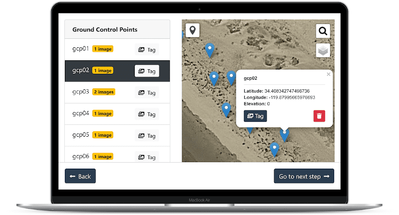
Custom GCP Mapping Tools & Drone Mapping Solutions
Managing GCPs manually can be time-consuming and error-prone. This is where custom drone mapping software helps.
At Manya Technologies, we develop:
- ✅ Custom GCP management tools
- ✅ Desktop & web-based drone mapping software
- ✅ OpenDroneMap customization
- ✅ GIS integration (QGIS, PostGIS, Cesium, OpenLayers)
- ✅ Automated accuracy validation workflows
Our solutions reduce manual effort while ensuring survey-grade results.
Conclusion
Ground Control Points (GCPs) are the backbone of accurate drone mapping. While modern drones and software are powerful, GCPs ensure maps are:
- Precise
- Reliable
- GIS-ready
- Engineering-grade
Whether you’re working on infrastructure, mining, agriculture, or defense projects, GCPs turn drone images into trusted geospatial data.
If you’re looking to build custom GCP mapping tools or end-to-end drone mapping solutions, Manya Technologies can help you design cost-effective, scalable, and offline-capable systems tailored to your needs.
📩 Contact Manya Technologies today to elevate your drone mapping accuracy.